 |
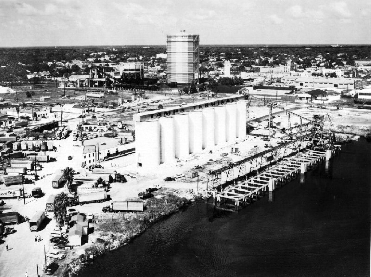
| TampaTerminal on the Ybor Channel looking North, Northeast towards the Tampa Gas Company storage tank (1956) |
Somehow while searching for historic pictures I came across a collection of historic aerial photographs digitized by the University of South Florida that I had never seen before, The Graber Collection of Florida Aerial Photographs. The USF website for the collection states: "As early as 1949, Robert Graber and his company, Airflite Aerial Photographers, began photographing the growth of Florida's west coast. By the time Graber stopped taking aerial photographs in 1990, the St. Petersburg photographer had accumulated approximately 27,000 aerial shots, many of which are presented here.
The Graber Collection of Aerial Photography consists of more than 8,000 individual photographic negatives spanning 1949-1990. The photographs are dated and indexed according to the records of the original photographer; logbooks provide additional information about many of the aerial shots. Most of the photographs, which were taken by Graber with a K-24 military surveillance camera, document land development and construction on Florida's west coast. The collection was donated by Ken and JoAnne Taylor in 1997. There are 4,781 images online from the years 1956-1959."
While most of the photographs available online seem to be of development along the Pinellas beaches and in Pinellas county, there are some great shots of Tampa and development taking place there during 1956-1959. Many are shots from angles I am not use to seeing or of areas that didn't get a lot of attention from the Burgert's. Please keep in mind that most of the photos are low resolution or low quality. Below are some highlights:
 |
| Railroad tracks through Hyde Park and Dobyville are looking Southwest centered over Platt and Dakota (1957) |
 |
| First Gandy Bridge, with drawbridge on the Right and the Second Gandy Bridge on the Left, current crumbling Friendship trail bridge (1956) |
 |
| Dale Mabry and Gandy looking North centered over the old Dale Mabry Drive-in and the Tampa Jai-Lai Fronton. I believe this photo also shows what looks like an overpass taking Dale Mabry over the railroad tracks (1956). | | | | | | |
|
|
|


i could connect you with Mr. Grabers grandson. They lived 5 houses down from me in st. petersburg during my childhood.
ReplyDeleteThank you, for checking out my blog. I'm not sure which post you are talking about, but this particular blog entry doesn't have a video. I have shared a few videos that I think are relevant to Tampa history or that I think or interesting or insightful. My favorites being: http://tampaniatampa.blogspot.com/2011/08/hub-of-downtown-existence.html and http://tampaniatampa.blogspot.com/2011/11/bro-bowl-doc.html
ReplyDeleteIt's been awhile since I've posted, but hopefully I still have a few more posts up my sleeve.